2017, Travels

Black Canyon of the Gunnison

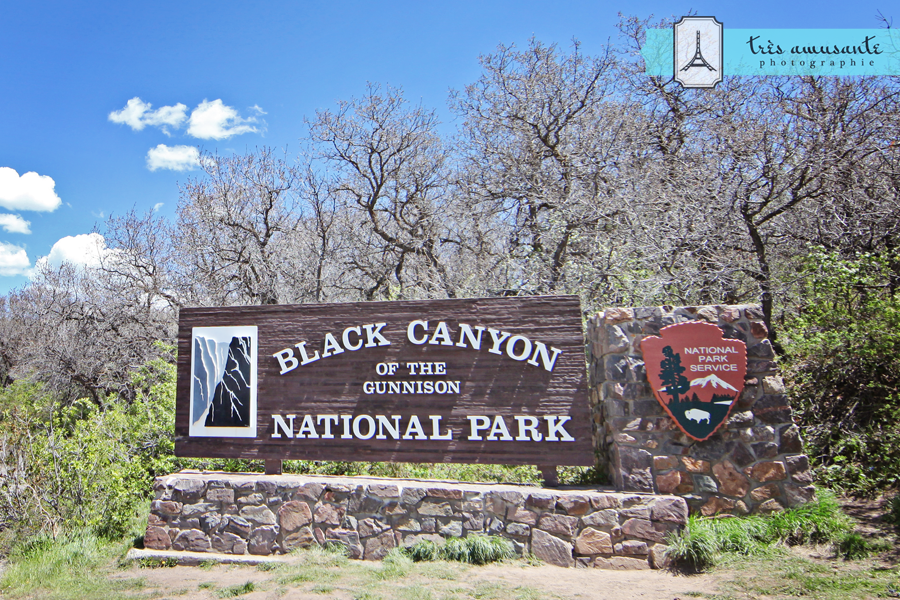
The second stop on this year’s Southwest Adventure was Black Canyon of the Gunnison National Park. Justin visited the park a number of years ago and was eager to return. My interest was sparked when I discovered that it’s registered as a Dark Sky Park, so I knew it would be a great spot to do some Milky Way photography. Seeing an opportunity, my darling Justin talked me into camping, in a tent, in bear country.

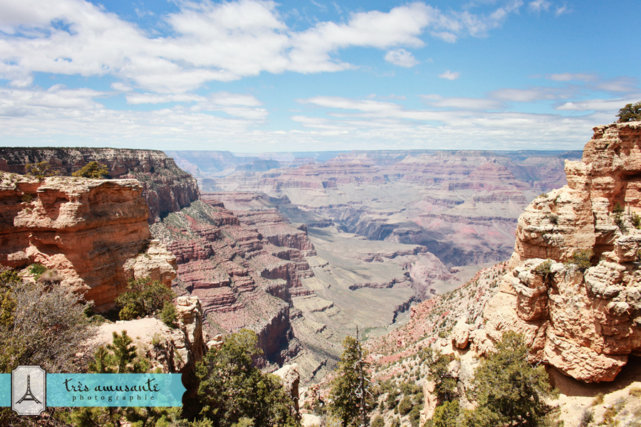
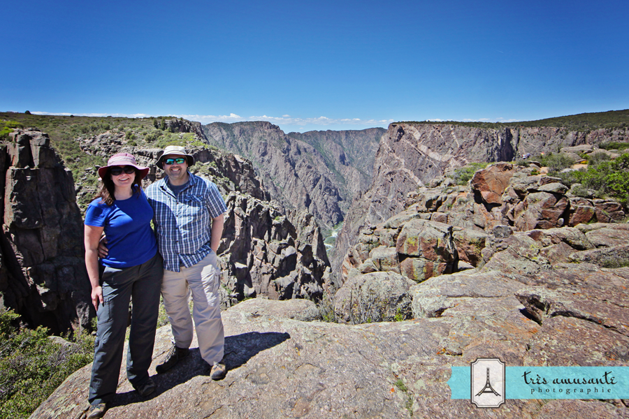
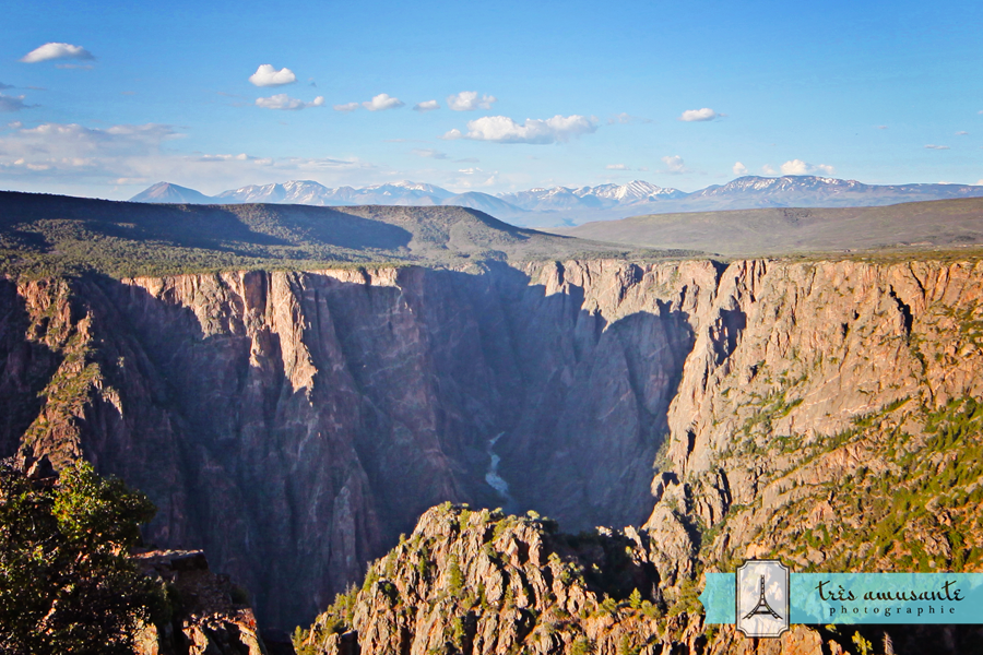
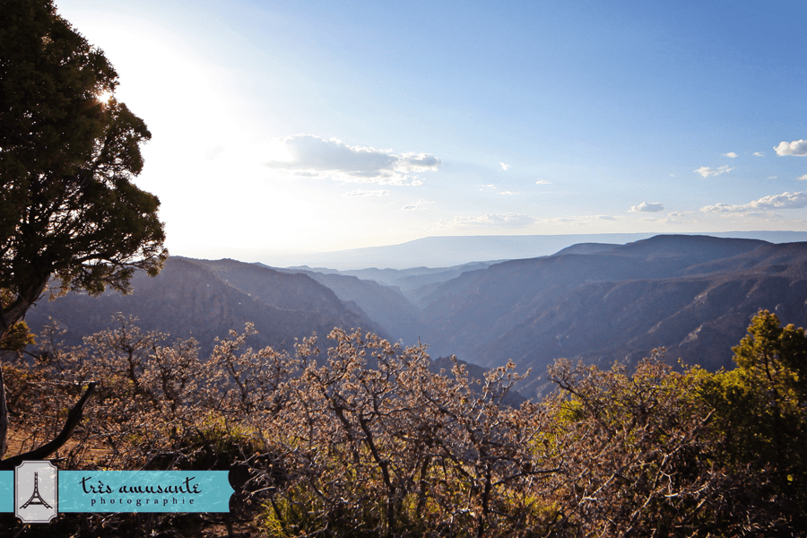
Black Canyon of the Gunnison is one of the steepest and narrowest canyons in the North America. Parts of it lie in almost perpetual shadow and darkness, which is how it earned the “Black Canyon” moniker. It’s a pretty impressive sight, and a very vertigo-inducing one.

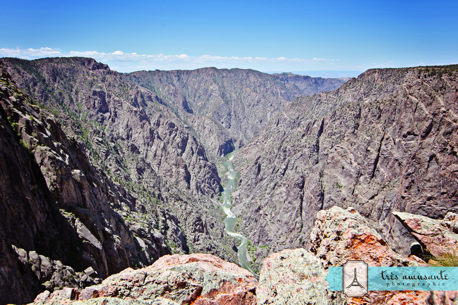
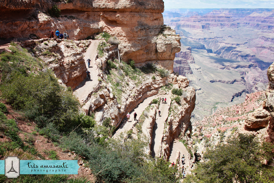
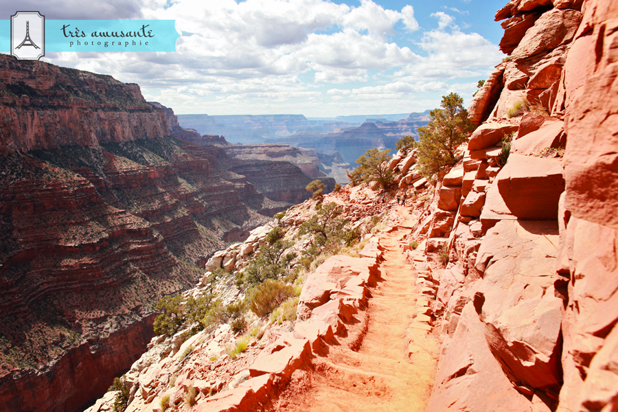
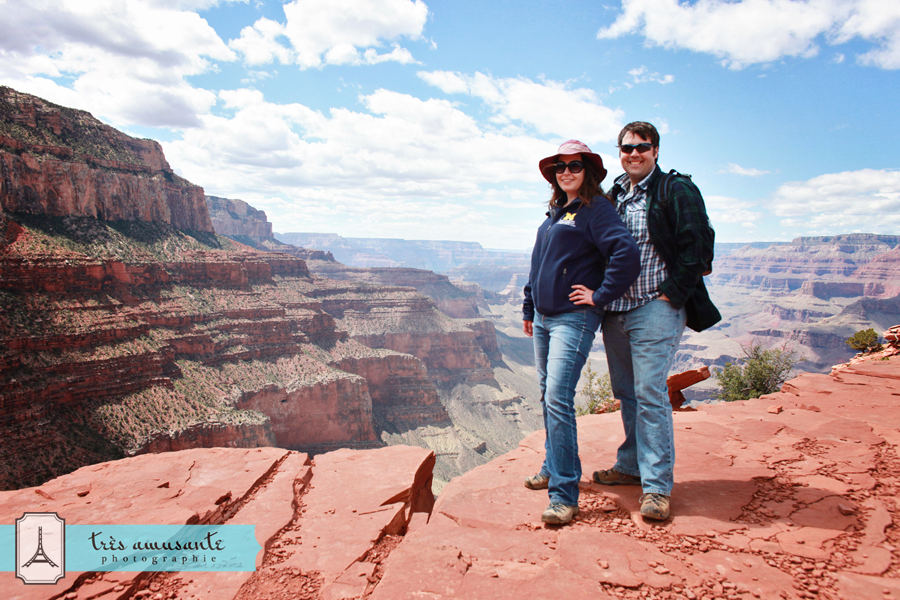
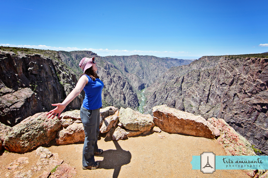
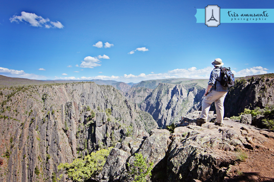
Every time we stopped at a lookout, I said the same thing. “Wow!” And, “Wow!” Then another, “Wow!” And, “I know I’ve said this already, but, wow!”

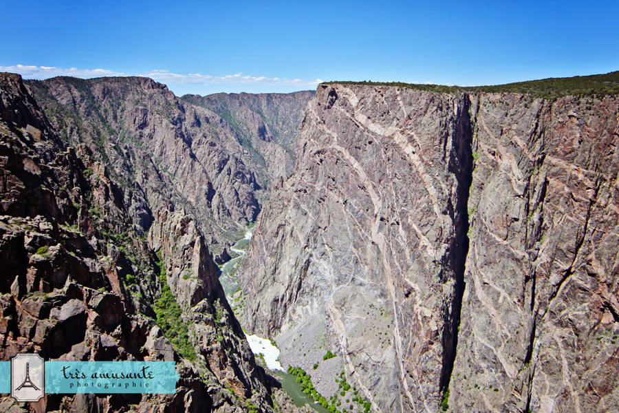
Many of the Black Canyon’s cliffs are just sheer walls of rock, Colorado’s version of The Cliffs of Insanity.

This shot is called “Where are my dragons?” Game of Thrones fans will understand…

After a long day of hiking, we were ready to relax in our rustic digs. Ah, tent, sweet, tent.

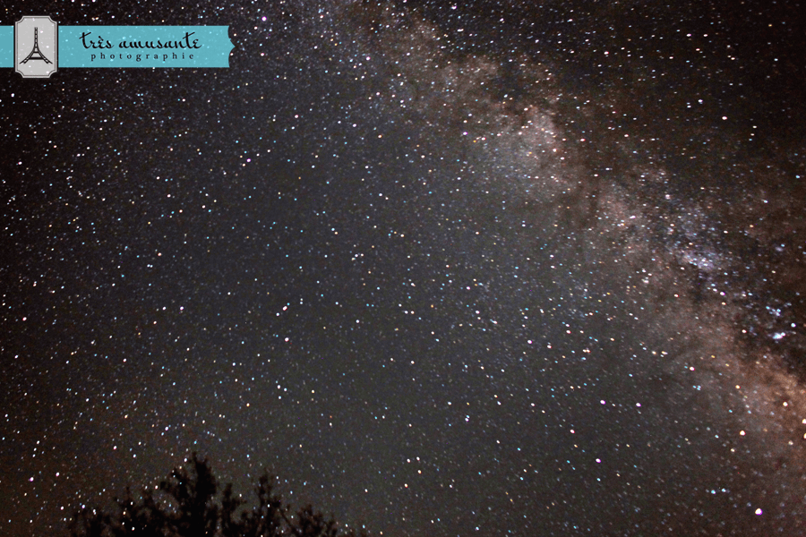
As I mentioned, the primary reason I agreed to camp was to have easy access to the Black Canyon’s dark sky properties. So, I set an alarm for 2:30am so I could get up and experience that dark sky in all its glory!

I won’t lie: every little noise I heard had me scared. Out. Of. My. Mind. Scared. Night photography in bear country is definitely not for the faint of heart!

But, it was an amazing experience and I’m so glad I was brave enough to give it a shot. And, I got some cool shots!

2017, Travels

Rocky Mountain National Park

We kicked off our third annual trip to the Southwest in Estes Park, Colorado. (We probably should have kicked it off by spending a night in Denver, as recommended, to adjust to the altitude, but hindsight is 20/20…) Aside from the mild altitude sickness I experienced, I really liked Estes Park. The cute little town, full of cute giant elk, is the gateway to Rocky Mountain National Park.

This year, the Rockies received an unseasonal three feet of snow in late May. Most of it had melted by the time we arrived, but we decided to hike around in one of the spots where it was still thawing, because apparently, it’s my secret desire to fall down in all 50 states. After slipping and sliding along on the trail, I was relieved to make it to Nymph Lake in one piece.

After leaving Nymph Lake, we continued along the trail to Dream Lake. Every so often, we stopped to rest and admire the incredible views, and pose for photos.

Dream Lake welcomed us with all the glory of an alpine paradise. At 9,905 feet above sea level, you lose your breath from the altitude and the beauty of it all. We were light-headed and giddy, but in the most wonderful way in the most spectacular place.

2016, Travels

Mammoth Cave

Instead of driving several hours north to celebrate my birthday, this year we drove south. Kentucky is the land of bourbon, the fastest two minutes in sports, and the world’s largest hole in the ground – Mammoth Cave.

Mammoth Cave has over 400 miles of underground tunnels. That’s a lot of dark places for people to get lost, so the only way to tour the cave is while guided by a ranger of the National Park Service. The NPS offers a number of tours, from easy hikes to hard-core spelunking. And it turns out, they book up several weeks in advance during the summer months. We weren’t able to book a couple of the ones we wanted to take, but we did snag some spots on the Historic Tour which enters the cave at the historic entrance.

Tripods and flash photography are not allowed on the Historic Tour, so I had to shoot at a really high ISO and a really long shutter speed to get any acceptable images. Those are not exactly the camera settings I prefer to use, but I made do.

In the afternoon, we rode a shuttle bus to a different part of the park for the Domes and Dripstones Tour.

This tour ends in what’s called Frozen Niagara. It’s the most photographed section of the cave and it was easy to see why – it was an awesome mix of creepy and spectacular.

2016, Travels

The South Kaibab Trail

We checked out the North Rim of the Grand Canyon last year, so this year, we explored the South Rim. We wanted to challenge ourselves with a strenuous day hike, and the South Kaibab Trail certainly fit the bill. If you’ve never hiked at the Grand Canyon, you probably shouldn’t start with this trail, and if you do, don’t say I didn’t warn you! But if you know what you’re getting yourself into and are looking for a trail that will kick your butt, the South Kaibab Trail is it!

The trail begins near Yaki Point with a sweeping panoramic view of the natural wonder that is the Grand Canyon.

From the trailhead, it’s a steep descent down the switchbacks cut into the rock.

This trail is so steep that even going down is tiring, especially when you’re carrying 20 pounds of camera gear on your back. So I took a lot of breaks to rest and admire the views.

After a while, the ramp of the trail turns into stairs, which somehow made it seem steeper.

Presenting: a view of Cedar Ridge, from somewhere near Ooh Aah Point.

We had planned to go all the way to Skeleton Point, but when we saw how inviting and beautiful Cedar Ridge was (and realized that we still had to go back up), we decided to stop.

You don’t haul a tripod into the Grand Canyon and leave without getting a shot like this:

This was, hands down, the most difficult hike I’ve ever done. I don’t recommend it unless you are willing to be physically punished. But if that sounds appealing, you won’t be disappointed! It’s an astonishingly beautiful trek and something that everyone should see with their own eyes!

2015, Travels

Bryce Canyon

I truly enjoyed every single place we visited on our Southwest trip, but if I had to pick a favorite spot, Bryce Canyon would win. I was smitten with the weather, the landscape, the cabin where we stayed, the little general store we visited at least a dozen times in two days and the older gentleman behind the counter where we bought our fishing licenses (for our upcoming adventure on Lake Powell) who tried to convince me stay behind by offering me a job – I just loved everything about this part of Utah!

Bryce Canyon National Park was pretty cool too…

We started our day at Sunset Point, and began by descending the steep switchbacks on the Navajo / Queens Garden loop trail. That’s Justin hiking along the path. It was pretty amazing and intimidating to see the zigzag trail in person – this shot really doesn’t do it justice.

By the time we reached the canyon floor, we were 500 feet lower than we were when we started.

Here’s a fisheye shot of the hoodoos from the canyon floor. Can you see why I liked this place much? It was incredible!

We finished the trail at Sunrise Point, and I had to give Justin a celebratory smooch.

The views from the rim trail were pretty fantastic too.

I used my 24mm lens to get a selfie of us with the hoodoos.

As dusk approached, we went for a drive to try to find a good spot to watch the sun set (not that the view from any spot was bad…) and we checked out Natural Bridge.

We ended up at Rainbow Point (I think) for the sunset. Wherever we were, I dare you to argue with that view…

Before we left, I insisted that we stop to adopt a prairie dog. Justin supported that idea, but was mortified that I named our little guy Buster.