While riding along in the rental car on our way into California to meet up with his mom and step-dad in the Sierra Nevada mountains, Justin made an impromptu decision to take us through Death Valley National Park. He had visited it before and insisted that it was well worth the detour to spend the afternoon checking it out. Death Valley has the honor of being both the hottest location and holding the lowest elevation of any point in North America. And with the allure of some interesting geological oddities to photograph, I was fired up to go exploring!

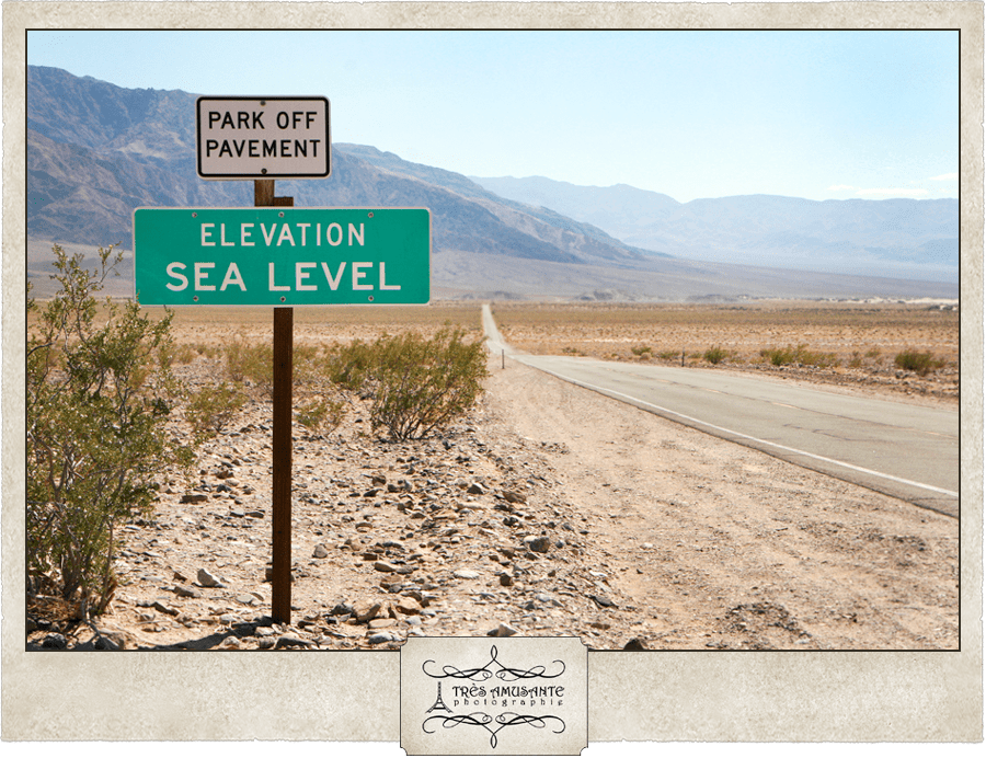
We entered the park at an elevation of around 800 feet above sea level, the same elevation as our native Ann Arbor. That elevation quickly dropped, and we watched the numbers tick away on a GPS device as we drove. It was like a New Year’s Eve countdown as we neared sea level, with a few horn honks and cheers when we arrived. From that moment on, it was literally all downhill from there!
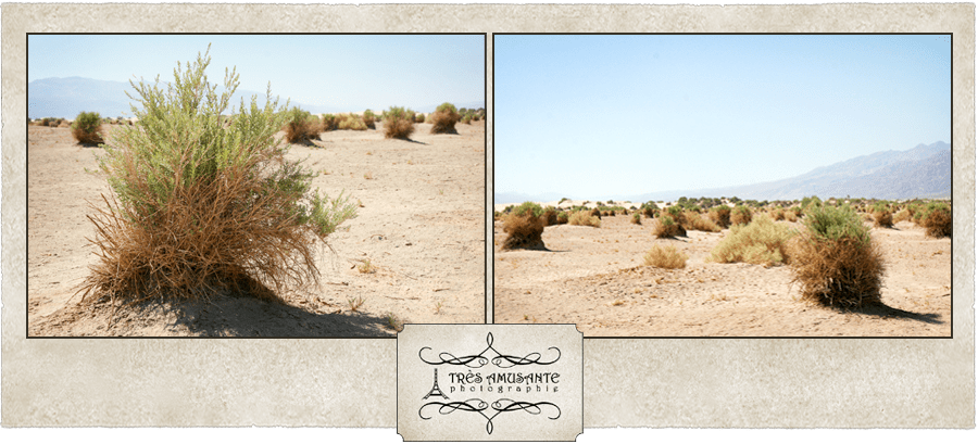
The first place we stopped to have a look around was called the Devils Cornfield. They look to me like tumbleweeds, before they’ve started to tumble.
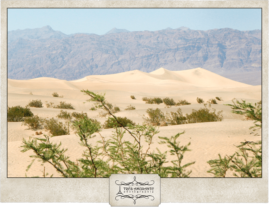
Then we moved on to the Mesquite Flat Sand Dunes – a beautiful, graceful and ever-changing intrigue in the harsh desert. When I first saw the dunes, I couldn’t wait to run all the way out there and play in the sand. That feeling fled when I got out of the car and actually felt the sand. To say it was hot doesn’t say enough… It was burning, baking, blistering hot! It was seriously like walking on tiny hot coals. So we didn’t stay very long…

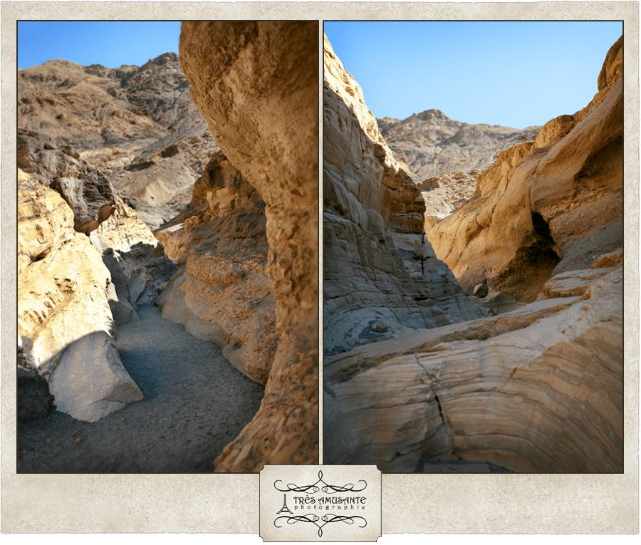
When we stopped to wander through Mosaic Canyon, it suddenly occurred to me that since we were now in California, we were in an area of frequent earthquake activity. So I asked Justin how far we were from the fault line. “How do you think the mountains were formed?”, was his oh-so-comforting reply.


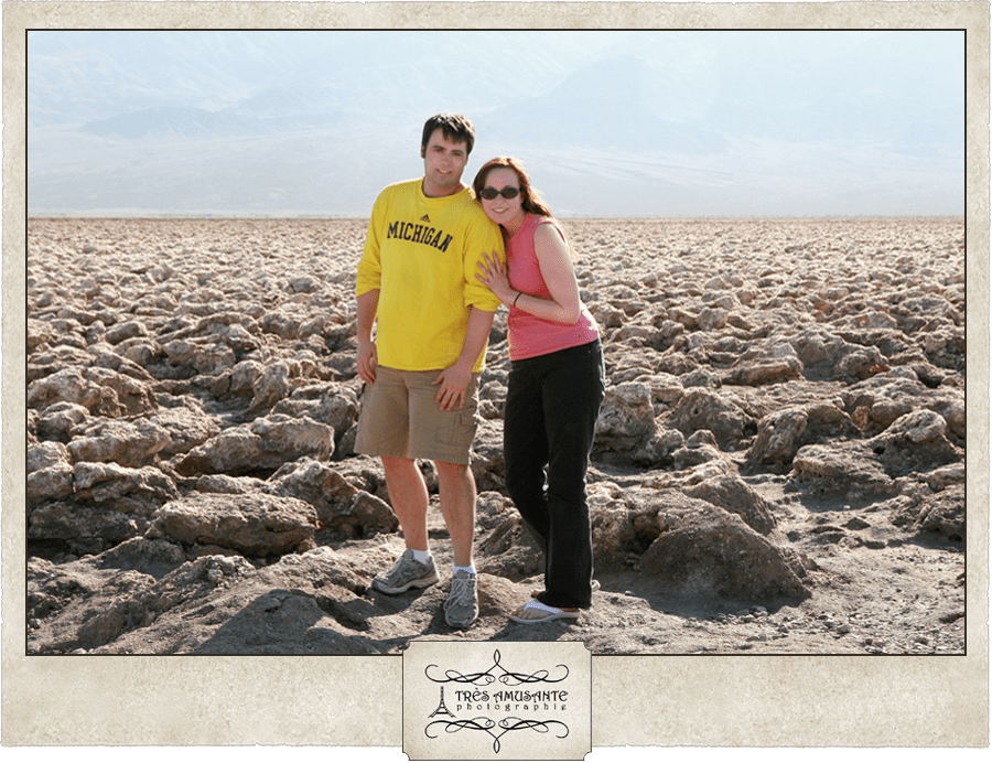
The next stop was the Devils Golf Course – a series of strange salt formations left behind by a long since evaporated lake. We pretended it was the surface of Mars, held a ceremony for our ‘landing’ and took our shuttle crew photo.

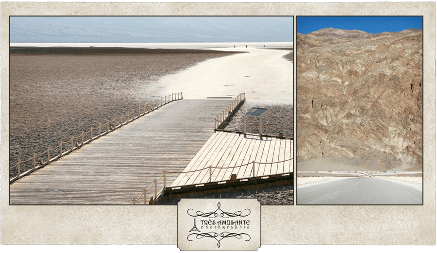
We had to stop at Badwater Basin, if only to say we visited the point of lowest elevation. At 282 feet below sea level, the air is thick, the heat is dizzying and then there’s the water… The high salt content and nasty appearance of this pool led to it earning the name of Badwater. Though it isn’t safe for humans, there are a few plants and animals that thrive in the soupy liquid.
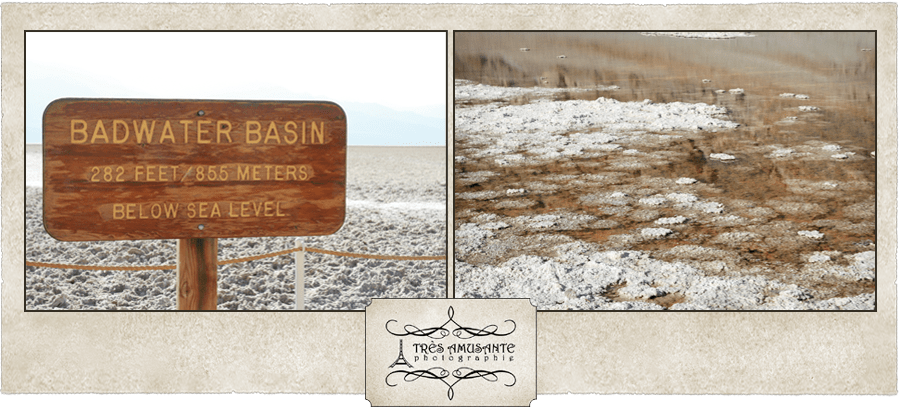
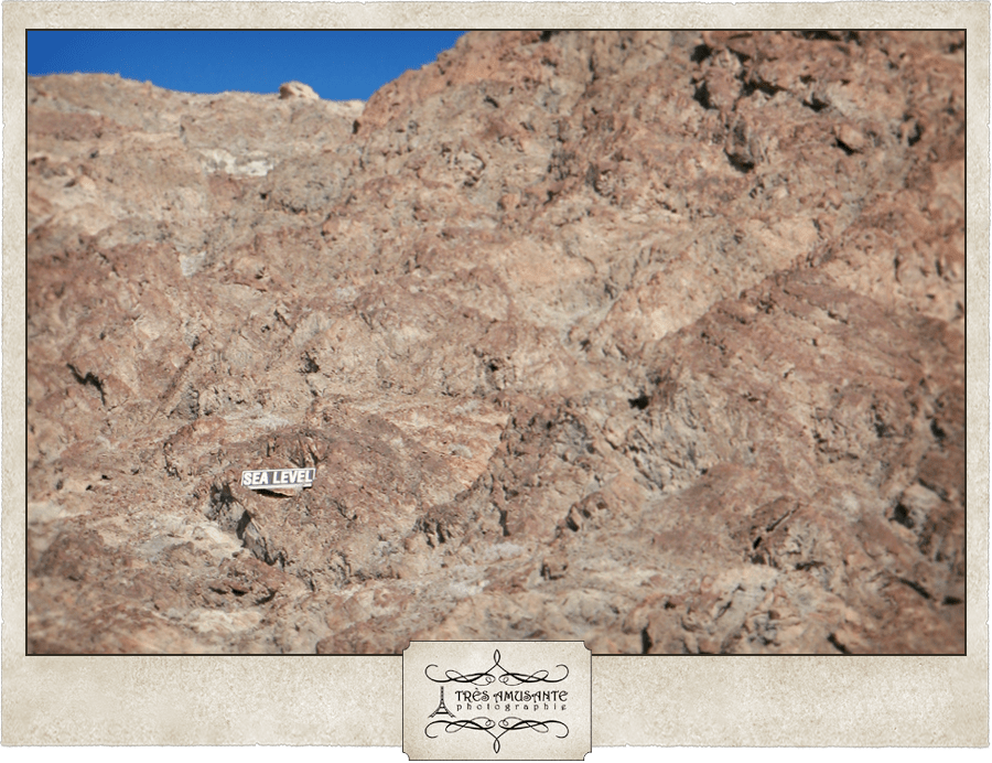
A sign perched high in the mountainside above the parking lot noted where sea level was and provided an eerie reminder of how far down we’d gone.
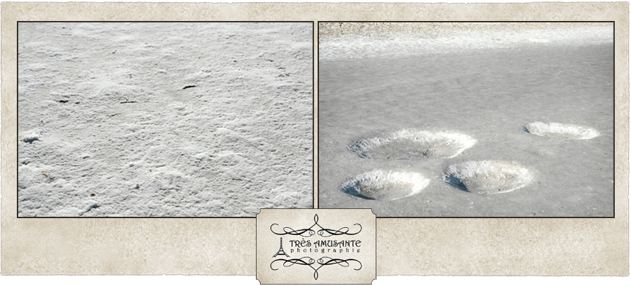
When we started out on the long walk along the salt flat, we had no idea how hot and miserable this walk would be. The 110 degree air temperature hadn’t really affected us much all day, but that changed with this walk. The sunlight reflected off all of the salt and the heat just hung in the thick air. When we turned back, we had an interesting perspective. See that tiny white speck in the center of the photo? That’s the sea level sign above the parking lot. It blew our minds.
Although it was oppressively hot, it was pretty cool. The salt reminded me of the moon, craters and all.
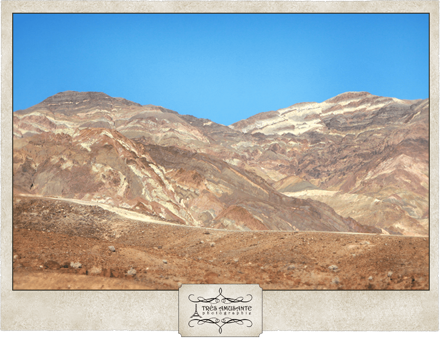
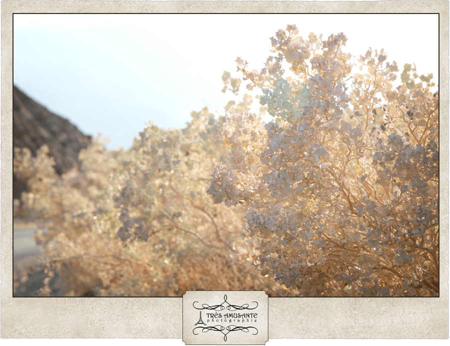
To complete our day in the desert park, we took a drive through Artist’s Palette. The mineral deposits in the mountains create a rainbow of color when lit by the sinking sun. I was fascinated by the way the light made the desert holly seem to glow. It was amazing to see such incredible beauty in such a punishing environment.